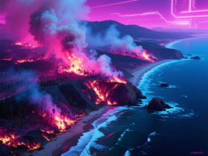
A recent wildfire has severely affected Santa Rosa Island, the second-largest island in California’s Channel Islands National Park. This event was documented by NASA’s Landsat 9 satellite, which provided critical imagery of the blaze.
Fire Development and Impact
The wildfire was first detected from aircraft on May 15, 2026, and confirmed by the National Park Service that same morning. By May 16, the Landsat 9 satellite captured images showing that the fire had already charred approximately 5,690 acres (or 2,300 hectares) of land. This area continued to expand, and by May 19, the total burned area reached around 16,600 acres (approximately 6,700 hectares), affecting much of the southeastern quadrant of the island.
Imagery Analysis
The images taken by Landsat 9 utilized both false color and natural color techniques. The false-color image highlighted the burned areas in dark brown, while the active fire front appeared in bright orange, revealing the infrared signature of the flames. The natural color image depicted the same region as it would be seen by the human eye, with gray-white smoke billowing over the dark blue waters of the Pacific Ocean.
Ecological Context and Cause
Santa Rosa Island is renowned for its rich biodiversity, often referred to as “North America’s Galapagos.” The fire has raised concerns as it burned near a rare stand of Torrey pines, a species that only grows naturally in this region and near San Diego. While officials have indicated that the fire was human-caused, investigations are ongoing to determine the specific circumstances surrounding the ignition.
The closure of the island to the public during firefighting efforts underscores the urgency and scale of the response required to manage this ecological crisis. The situation remains dynamic, with the fire perimeter still uncontained as of the latest reports.
This article was produced by NeonPulse.today using human and AI-assisted editorial processes, based on publicly available information. Content may be edited for clarity and style.
Original source: science.nasa.gov